 Black Lake
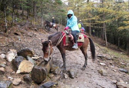 Mule rider
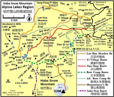 Alpine Lakes Region Trekking Map
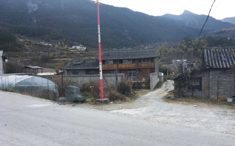 Dirt lane
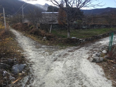 Dirt path leading left
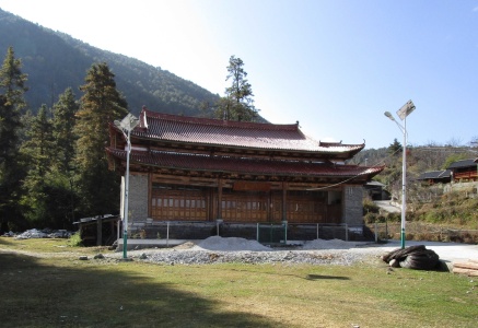 Mosque
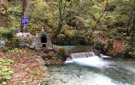 Spring at base of the route
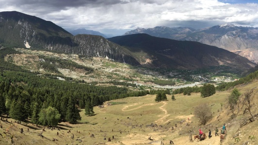 Upper edge of Hongtupo Meadow
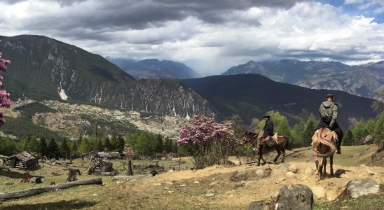 Xiaoqila Meadow
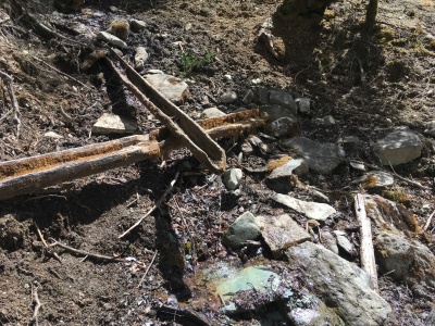 Xiaoqila Meadow spring
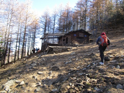 Daqila Shelter
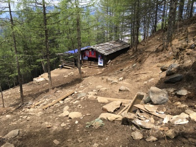 Spring above Daqila Shelter
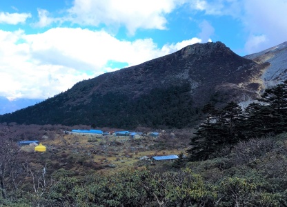 Base Camp
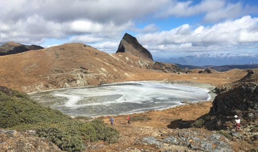 Round Lake
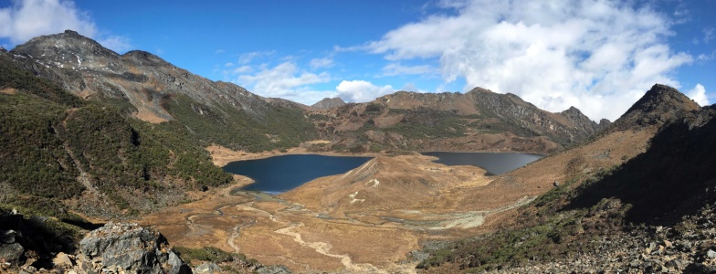 Black Lake from the south
Info
Please read the explanation of hiking times, distances, altitudes and rating levels here.


The Base Camp Route provides one of three standard approaches to Black Lake (黑海). The others are Lanhua Meadow (兰花坪路线) and Jianshan (尖山路线). Hiring a guide is recommended for each route.
Base Camp
Mountain climbers ascending Haba Snow Mountain travel the path in large numbers. Most stay overnight at Base Camp and attempt the summit the next day or following an additional day of acclimatization. Trekkers who do not intend to reach the top are welcome to stay at Base Camp. For information about facilities and fees please see the Base Camp page.
Base Camp Route is the standard approach to climbing Haba and is used by many mountain guides. This includes guides from On the Clouds Inn of Haba (云上哈巴客栈), which is located in the Hui hamlet of Longwangbian (龙汪边). Guides from Haba Snow Mountain Inn (哈巴雪山客栈) use the Alternate Base Camp Route, which joins the standard route just above Xiaoquila Meadow (小七拉坪).
Path Conditions
Over the years, the path to Base Camp has received heavy use from thousands of mountaineers and mules. This has caused major erosion, deep rutting and a proliferation of paths. Under wet conditions the track may turn into a muddy mess. Needless to say, the trek can be unpleasant. Riding a mule can be a sensible alternative to walking.
Confusing Place Names
Depending on where ethnic peoples live, Naxi from Guluba (古鲁八) or Hui from Longwangbian, they will apply different names for the place names on Base Camp Route. This website uses the Hui terms, since the Base Camp Route begins at Longwangbian Village, whose residents belong to the Hui ethnic minority. Below is a chart with the different names.
| Elev. | Hui | Naxi |
| 3,100 | Hongtupo Meadow | Lower Hongtupo Meadow |
| 红土坡坪 | 红土坡坪下 | |
| 3,400 | Xiaoqila Meadow |
Upper Hongtupo Meadow |
| 小七拉 | 红土坡坪上 | |
| 3,600 | Daqila | Xiaoqila |
| 大七拉 | 小七拉 | |
| 3,800 | Ganhe | Ganhe |
| 干河 | 干河 |
| Duration: 1 hour 30 minutes |
Trailhead
The trailhead is located in the hamlet of Longwangbian. Most trekkers walk there from their guest house in Haba Village. For example, it takes 30 minutes from Haba Snow Mountain Inn. If you prefer a lift by car, you should arrange one through a guest house. There is no car park nearby.
For those walking, here are directions from Haba Snow Mountain Inn. Exit the Inn, turn left (south) and follow the main road downhill past shops and restaurants. Cross the bridge over the Seji River (色吉河) and continue beyond for 300 meters. At an intersection with a paved road and bulletin board (apparently not in use) on the left and a dirt lane on the right, turn right onto the dirt lane. Follow the lane a short distance to a bridge over a stream.
Immediately after crossing the stream, turn left onto a dirt path which leads uphill through fields. Cross the main road through the village and continue on the dirt path. After a few minutes, arrive at a cluster of houses and a paved road. Proceed up the road for a few hundred meters to a rock pillar with the words “On the Clouds Inn of Haba”. The guest house is on the right, the road you want to take goes left.
In a few minutes you will reach the mosque in Longwangbian Village. An English plaque on the building reads ‘The Xianggelila mosque’. In the forest behind the mosque a footbridge crosses a stream. There, at an elevation of 2,750 meters, the Base Camp Route officially begins (27°22’16“N, 100°7’42“E).
Trail to Hongtupo Meadow
After crossing the footbridge, the track turns right, passes the outlet of a spring and ascends steeply through the forest. Along the way cross a dirt road near a concrete bridge, pass next to a cement water tank, and traverse several switchbacks. In certain seasons, the cicadas living among the trees ‘sing’, creating a remarkably loud sound.
One hour from the trailhead you will reach a huge opening called Hongtupo Meadow (红土坡坪), at an elevation of 3,100 meters. Mountaineers and mules rest here before plodding higher.
| Duration: 1 hour 30 minutes |
After trekking higher for an hour, arrive at the next meadow, Xiaoqila. This smaller meadow sits at an elevation of 3,400 meters. Both this and the lower Hongtupo Meadow offer good views of the Haba Valley, from the Jinsha River (金沙江) valley in the east to massive 4,000-meter high Gan Mountain (干山) to the north.
For water at Xiaoqila Meadow, proceed as follows. Starting from the top of the meadow, head right (west) near the treeline to an abandoned hut. Continue further to a stand of trees and the spring hidden within.
Enter the woods above Xiaoqila Meadow and continue the ascent,. A trail joins in on the right soon after. That is the Alternate Base Camp Route (备用大本营路线). 30 minutes above the meadow stands Daqila Shelter (大七拉小屋) at an elevation of 3,600 meters. This is about the half-way point to Base Camp and marks the standard lunch spot along the way. During the busy season (first week of April and October) a caretaker resides here and tends a humungus pot of noodles for hungry hikers, for a fee. Mountain guides and mule packers rest inside and boil tea over the fire. Shelter space is limited, and trekkers should not plan to spend the night inside.
A spring just above the shelter provides water for man and mule. If the spring goes dormant, you’ll find another in the woods below the shelter. Look for a small pool under an overhanging rock with a tree growing on top. You’ll have to treat the water to make it safe for drinking.
| Duration: 2 hours |
| Duration: 2 hours |
To continue the trek to Black Lake, head west from Base Camp on a path that crosses over a low ridge and descends into a meadow with dilapidated huts. Ascend out of the meadow through stunted forest, and arrive above the tree line in an alpine valley. Here, the route to Jizhi Pass turns left (south) and ascends the valley in 30 minutes to the pass.
The track to Black Lake turns right (northwest). The route crosses over a rise and passes near Round Lake (圆海), elevation 4,250 meters, which is situated to the right. From Base Camp to Round Lake takes 1 hour 20 minutes. Descend in a westerly direction to Long Lake (长海) which sits in a sheltered basin at the base of a sheer rock peak. Follow the shoreline north and proceed downhill, reaching Black Lake 40 minutes after passing Round Lake.
| Region: Alpine Lakes Region | |
| Itinerary: Haba Village—Longwangbian Village—Daqila Shelter—Base Camp—Black Lake | |
| Duration: One-way: 5 hours to Base Camp; 7 hours to Black Lake | |
| Distance: One-way: 9 km to Base Camp; 13 km to Black Lake | |
| Altitude in Meters: Start 2,650. Max 4,250. End 4,100 | |
| Elevation Gain: 1,450 meters to Base Camp; another 200 meters to Black Lake | |
| Rating: Advanced | |
| Water Sources: spring at trailhead, Xiaoqila Meadow, Daqila Shelter, Base Camp | |
| Hiking Times: Haba Snow Mountain Inn to On the Clouds Inn of Haba 0:20 hr. Village mosque 0:30. Hongtupo Meadow 1:30. Xiaoqila Meadow 2:30. Daqila Shelter 3:00. Gan He 3:45. Base Camp 5:00. Round Lake 6:20. Black Lake 7:00. |